
 |
 |
 |
 |


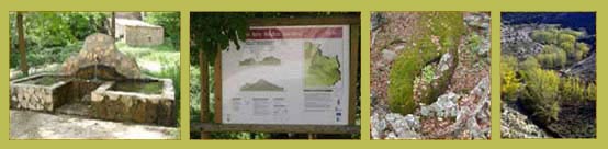
Route along the valley of the river linares
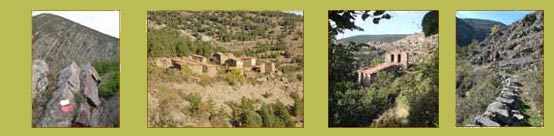
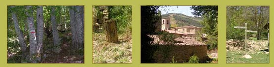
Trekking from Valdeperillo (La Rioja) to San Pedro Manrique (Soria) along the valley of the river Linares and through the abandoned villages of Villarijo, Peñazcurna and Vea.
See a bigger map
(Enjoy a virtual view withGoogleEarth)
See a bigger map
(Enjoy a virtual view withGoogleEarth)
GR 86
Soria has a GR (Long-Distance Footpath) through which you can discover the geography of our province: the Iberian and the Central Mountain Range. You will not need a compass to walk the roughly 500 km through the GR 86 and discover amazing places. The route is separated into 36 stages that are walked along paths, tracks, old roads, Roman roads and trails from six to over twenty kilometres long. The core of this footpath is an amazing discovering of the landscapes, culture, history and environmental resources of an almost virgin province. A route planned for all ages and all fit conditions. At the end of each section there is always a village or a town, which you can reach in less than a day. There are also some smaller paths along this way known as PR (short-distance footpath), marked in yellow and white stripes.
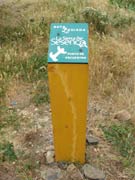
Follow the arrow: There are three different marks: two red and white parallel stripes that mean that the walker should go straight on; two red and white stripes on right angle that mean a change of direction (left or right) and a red and white cross that means that it is not the right way. There are also some wooden signs whenever there is an important change of direction, or to show different routes or the distance to the next village. All you need is walk and follow the marks.
Follow the arrow: There are three different marks: two red and white parallel stripes that mean that the walker should go straight on; two red and white stripes on right angle that mean a change of direction (left or right) and a red and white cross that means that it is not the right way. There are also some wooden signs whenever there is an important change of direction, or to show different routes or the distance to the next village. All you need is walk and follow the marks.
Stages in the Highlands:
1. Matalebreras-Magaña (23 km)
6 hours. 95% cycling. Finishing at the Mountain Range of Sierra del Madero and going into the Highlands.
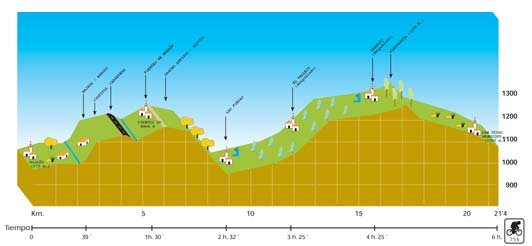
2. Magaña-San Pedro Manrique (21,4 km)
A rough path through the abandoned villages of Las Fuesas, Castillejo, El Vallejo and Sarnago. 75% cycling. 6 hours.
[Download the stage (PDF)]
[Download the stage (PDF)]
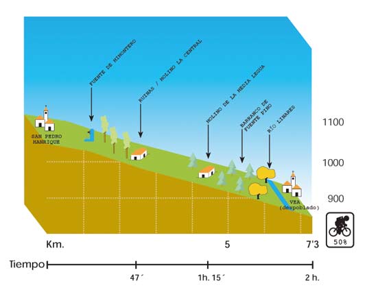
3. San Pedro Manrique - Abandoned village of Vea
Along the amazing and unknown valley of the river Linares. It continues to the abandoned villages of Peñazcurna and Armejún. 7.3 km. It will take over 3 hours (return). No cycling.
[Download the stage (PDF)]
[Download the stage (PDF)]
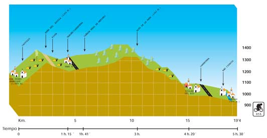
4. San Pedro Manrique-Yanguas (19,4 km)
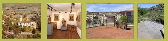
5:30 hours. Through the villages of Castillejo de Taniñe and Villar del Río, where the Paleontologic Museum can be visited. 85% cycling.
[Download the stage (PDF)]
[Download the stage (PDF)]
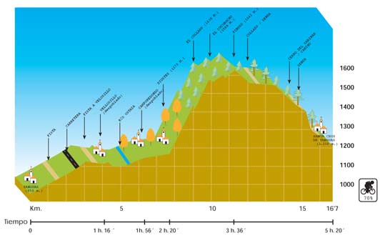
5. Yanguas-Santa Cruz de Yanguas (16,7 km)
5:30 hours. Through the beechwood forest of Diustes. Amazing views. 75 % cycling.
[Download the stage (PDF)]
[Download the stage (PDF)]
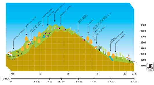
6. Santa Cruz de Yanguas-Almarza (21,6 km)
6 hours. Between the Highlands and El Valle (The Valley region). High altitude. Through beechwood forests, Garagüeta Hollywood and the Broch of Castillejos. 85% cycling.

[Download the stage (PDF)]
[Download the stage (PDF)]
Tour along the mountain range of


 Enjoy an unforgettable day; you will discover the past of this land throughout its history, geology, woods and inhabitants...
Every Thursday and Sunday in July and August.
You will need: Comfortable shoes and waterproof sandals to cross the river.
 Price: Adults 3€ and children free.
For more information visit www.santacruzdeyanguas.com and to book by phone: 0034 666 36 85 91
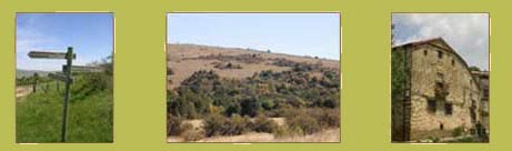
SHORT DISTANCE FOOTPATHS AND INTERESTING ROUTES
PR SO-22
From Villar del Río, following the river Cidacos you will pass Valduérteles and go into Bretún and La Laguna. Another possibility is to follow the river Cidacos and the river Baos to Santa Cruz de Yanguas and discover a spectacular unknown canyon full of beechwood forests and vegetation along the river side.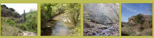
From Villar del Río, following the river Cidacos you will pass Valduérteles and go into Bretún and La Laguna. Another possibility is to follow the river Cidacos and the river Baos to Santa Cruz de Yanguas and discover a spectacular unknown canyon full of beechwood forests and vegetation along the river side.
VALDEPRADO-CIGUDOSA
From Valdeprado to Cigudosa, you can also go on to San Felices along the rivers Valdeprado and Alhama.
From Valdeprado to Cigudosa, you can also go on to San Felices along the rivers Valdeprado and Alhama.
ONCALA
Around Oncala, the visitor can walk along some pastures, hollywoods and oakwoods shaped by the action of cattle. The path goes along the Cattle Track and old trails. Do not forget to visit the Tapestry Museum and the Shepherds Museum!
Around Oncala, the visitor can walk along some pastures, hollywoods and oakwoods shaped by the action of cattle. The path goes along the Cattle Track and old trails. Do not forget to visit the Tapestry Museum and the Shepherds Museum!
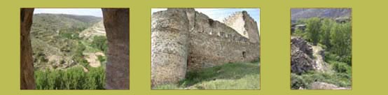
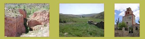
ABANDONED VILLAGES
During the 1960s and 1970s a policy of reforestation was implemented by the Patrimonio Forestal of the Government in the region of the Highlands over an area of 35,000 Has. The reforested villages were suddenly abandoned from one day to the other. The neighbours took their money and emigrated far from their place of origin. These villages are a scene of depopulation. After 40 years, they still keep their original structure but they have suffered a great deterioration. Nowadays they show a strange and mysterious look. The abandoned and opened houses invite the visitor to break into their privacy and see the way of living of their last inhabitants.
Routes through these villages:
Route 1

 LINARES VALLEY: Buimanco, Valdemoro, Armejún, Villarijo, Peñazcurna, Vea.
 Route 2:

 ALCARAMA MOUNTAIN RANGE: Sarnago, Acrijos, Fuentebella, Valdenegrillos, Valdelavilla, el Vallejo, Las Fuesas and Castillejo
 Route 3:
 MONTE REAL (Royal Mountain): La Mata, Lería, La Vega, Vellosillo, Camporredondo.
Route 4:
 BEECHWOOD FOREST: La Cuesta and Aldealcardo.
© Tourist Initiatives Center of the Highlands (Soria, Spain) 2009